Our next destination on the Carretera Austral was the Pumalín National Park. I visited this NP already in 2012 and loved it. It’s one of my favorite places in southern Chile.
The closest village to the Pumalín National Park is Chaitén. From Futaleufú to Chaitén it’s a 150 km drive which takes about 3 hours.
(Editor’s note: We were in Pumalín in March 2023.)
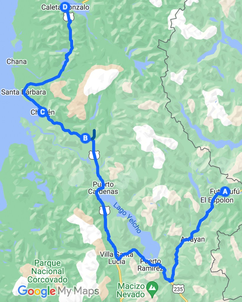
Chaitén
Chaitén has about 5000 inhabitants and is located directly on the coast of the Gulf of Corcovado. In 2008 the village was completely destroyed in a flood after an eruption of the nearby volcano. In 2011 Chaitén was rebuilt. Due to this Chaitén has a more modern appeal compared to the other villages along the Carretera Austral.


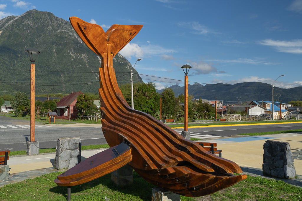
Rio Negro Valley
East of Chaitén is the Rio Negro next to the Carretera Austral. The valley of this river is very beautiful and worth a couple of quick stops.


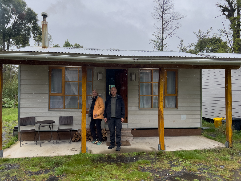
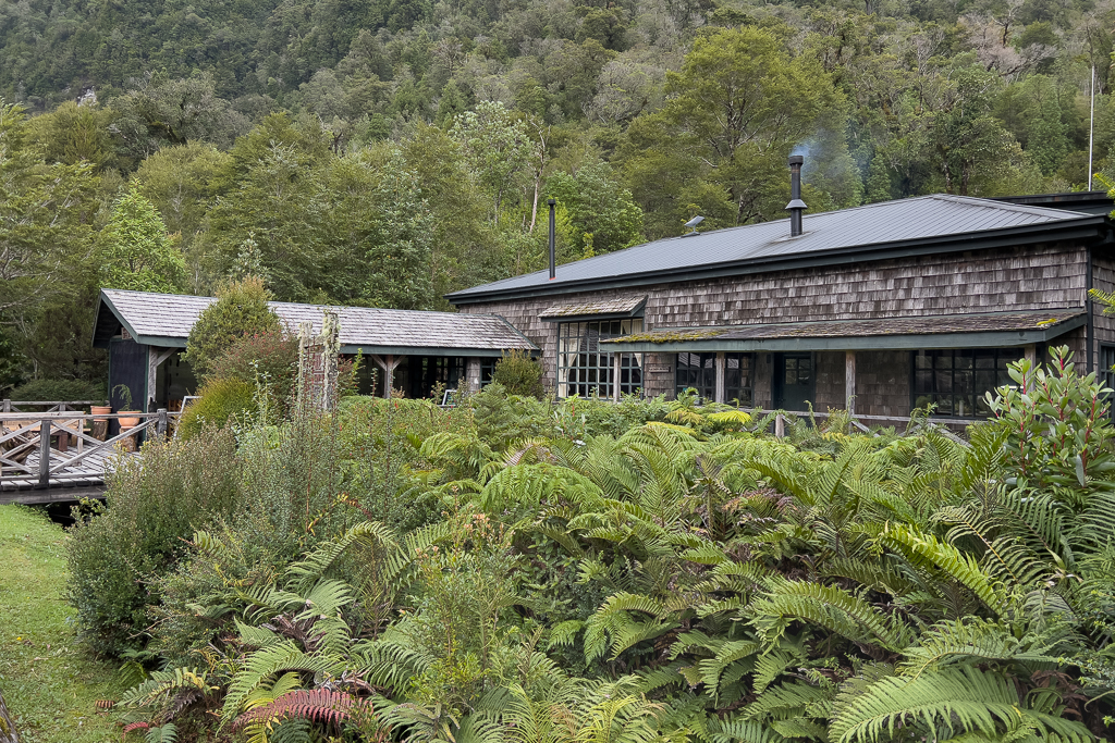
Halfway between Chaitén and the Pumalin El Amarillo Sector, we rented a cabin for the next 5 days as our base camp to explore the Pumalin NP.
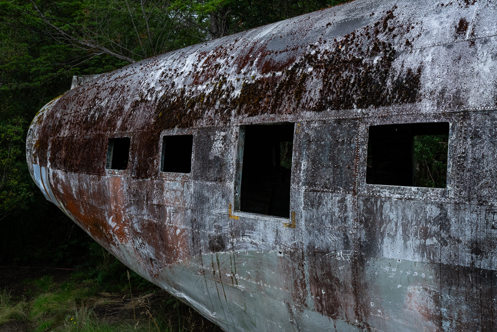
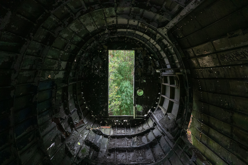
Close to our cabin was the small but lovely Café El Avion. The cakes that we tried there were the best in South America. A stop there is highly recommended.
Directly next to the café is a plane wreck of a DC-3 which crashed in Chaitén in 1974 (luckily with no fatalities). Later the airplane fuselage had been turned into a house with a chimney on top of it near the place of the original crash. For more information about the history of this plane take a look here. Now it belongs to the Café El Avion.


Sendero Ranita de Darwin
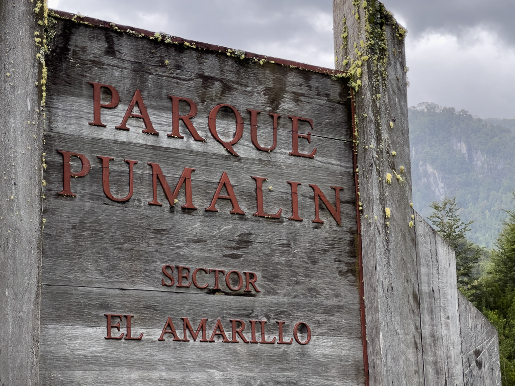
East of Chaitén you can find the Sector El Amarillo of the Pumalin National Park. It is not as well known as the other areas of the park but definitely worth a visit. To visit this sector you have to register at the El Amarillo office. The entrance to the park is free, but you need the registration. There are also some beautiful campgrounds in this area of the NP which you can use for a small fee.
In the Sector El Amarillo, we mainly explored the Sendero Ranita de Darwin.
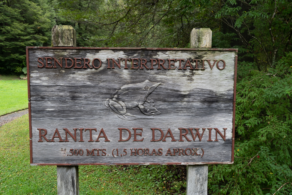
This trail is 4.5 km long and takes about 1.5 hours (or much longer if you stop as often as we did).
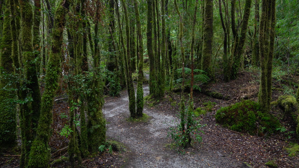
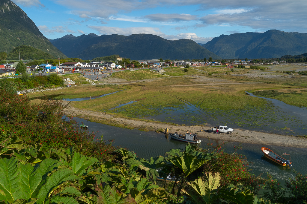
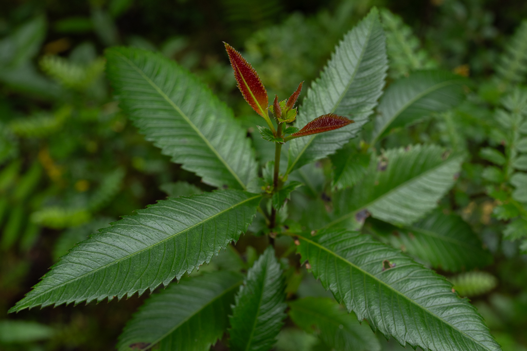
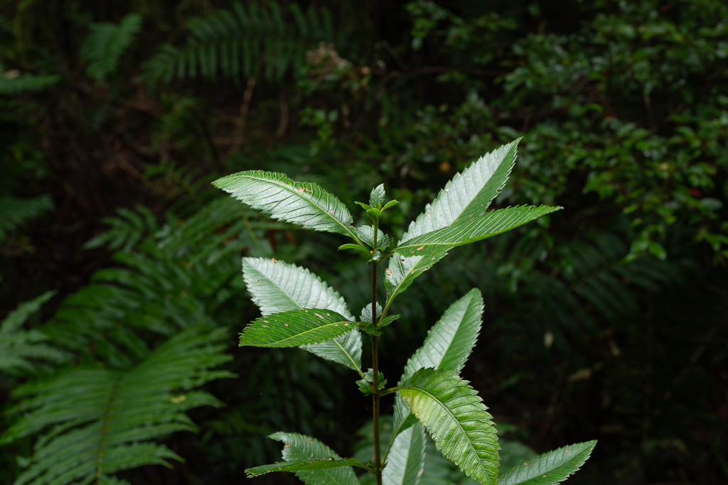
It leads through an extremely beautiful temperate rainforest with very diverse vegetation.


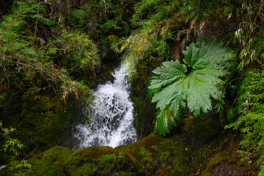
Along the way, you can find a couple of small waterfalls.


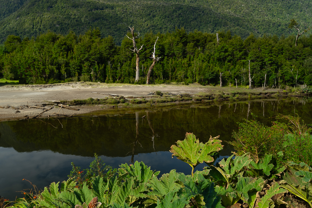
The nalca plants, also known as Chilean rhubarb or giant rhubarb, often have huge leaves of up to 2.5 m. It’s a very typical plant for the Chilean temperate rainforest and can be found in many places along the Carretera Austral.

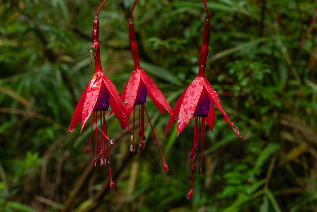
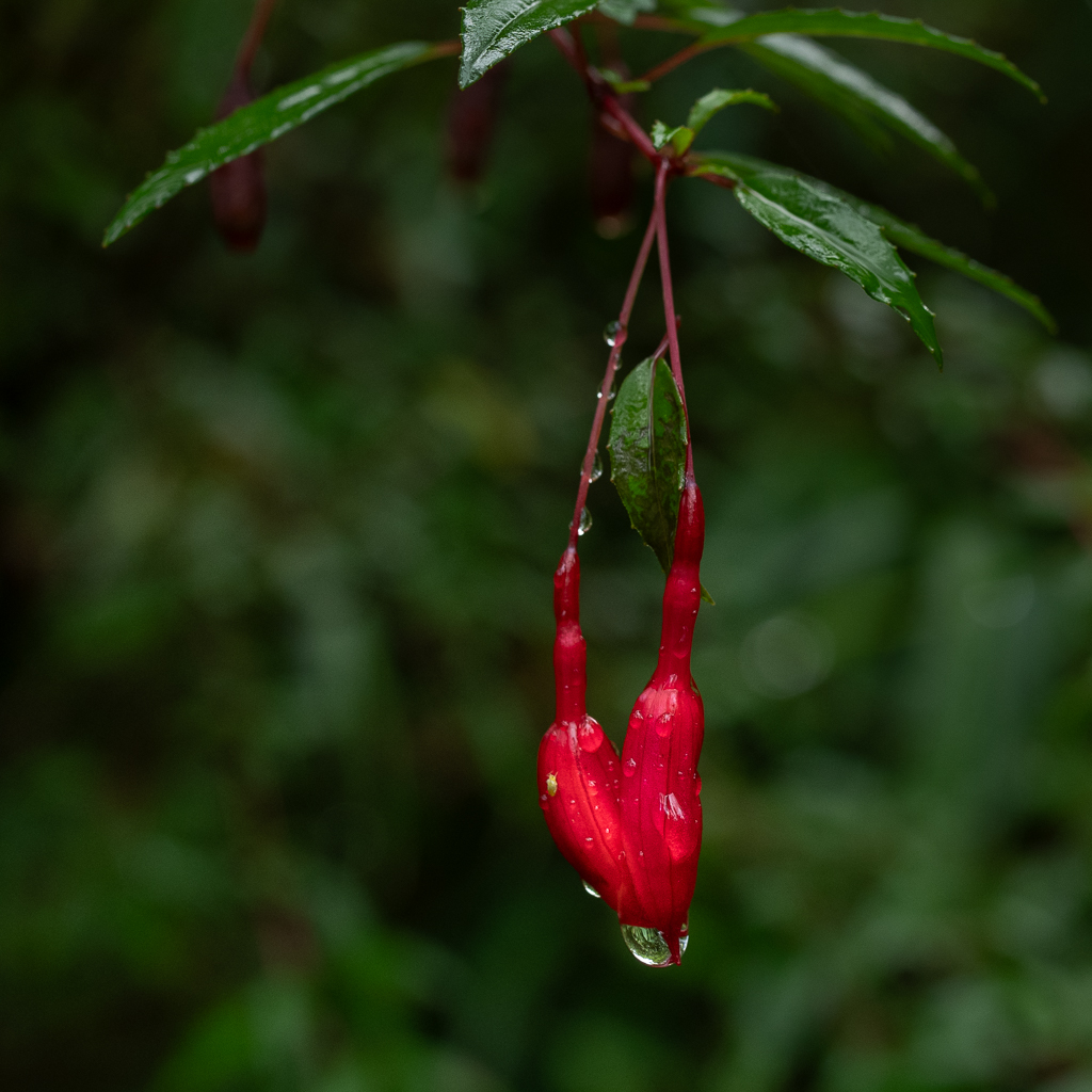
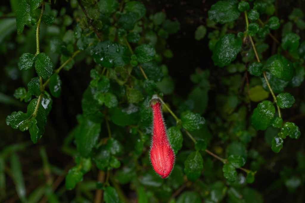
Colorful flowers are normally a rare sight in a temperate rainforest, but at the Sendero Ranita de Darwin, they were abundant. A pleasant surprise.


It’s important to not miss all the little details. They can often be as stunning as the larger trees.


The lichens and mosses on this trail were fascinating.


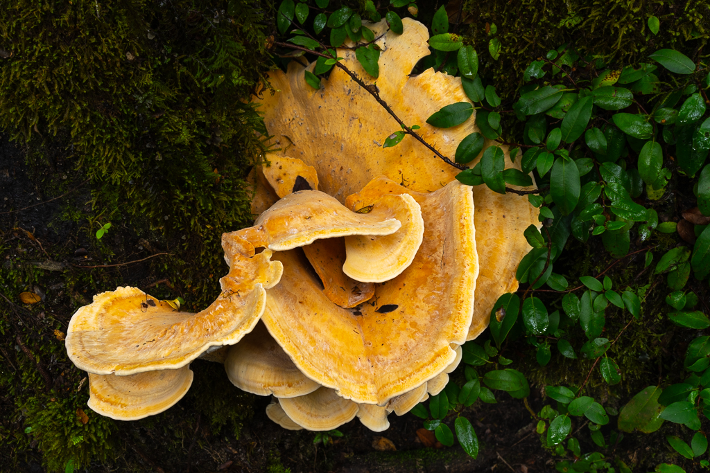
And not to forget the colorful tree fungus.

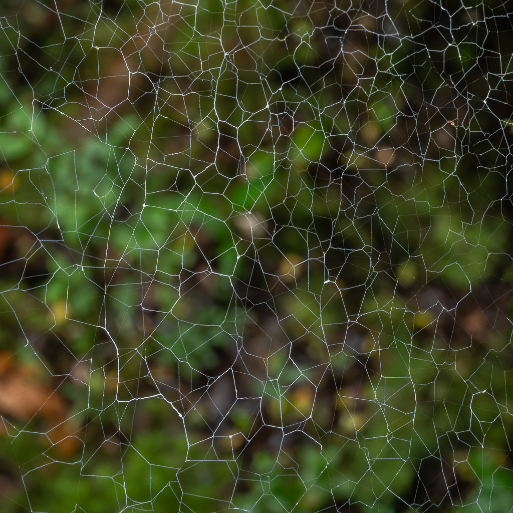
The spider webs often showed spectacular geometric patterns.


Altogether we spent nearly 3 hours on this trail with countless stops for photography and really enjoyed the short hike.
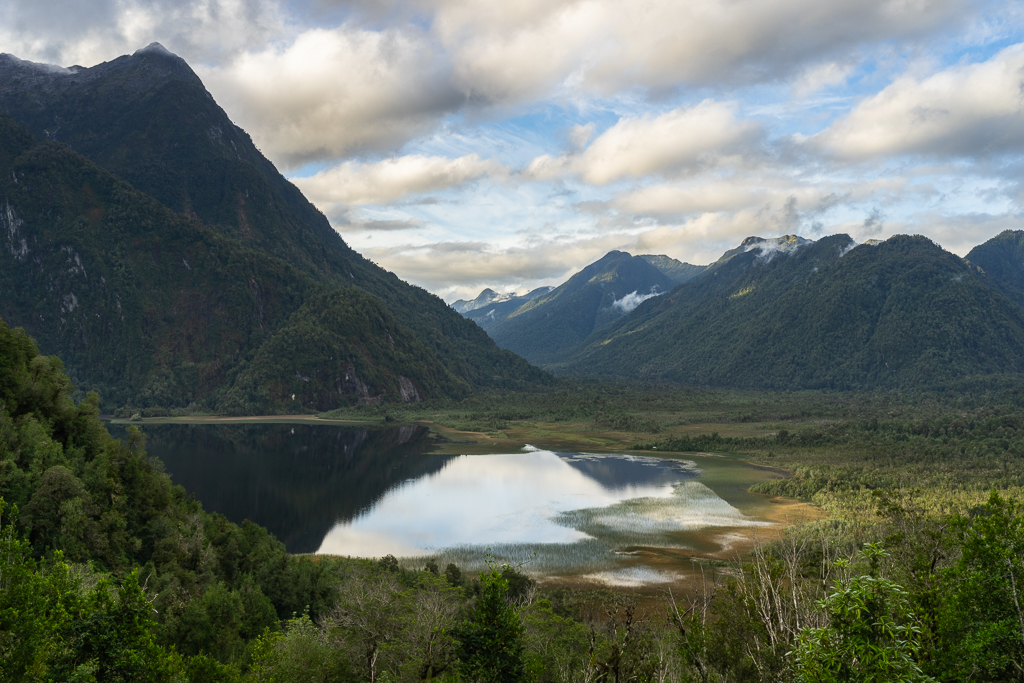
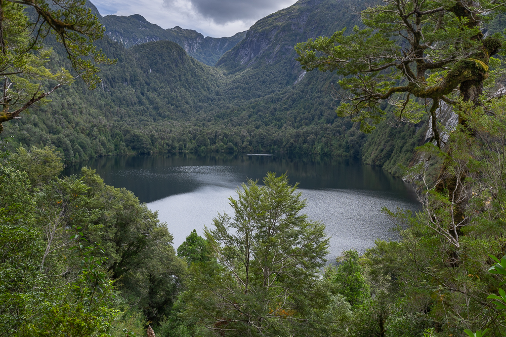
Rio Blanco, Volcán Michinmahuida and Lago Rio Negro
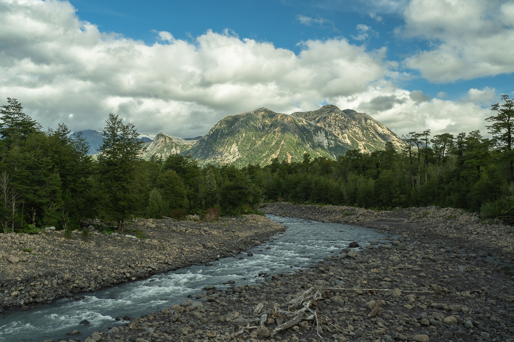
The main sector of the Pumalin National Park is located north of Chaitén. Shortly after entering the national park, you have a nice view of the Rio Blanco and the Volcán Michinmahuida.
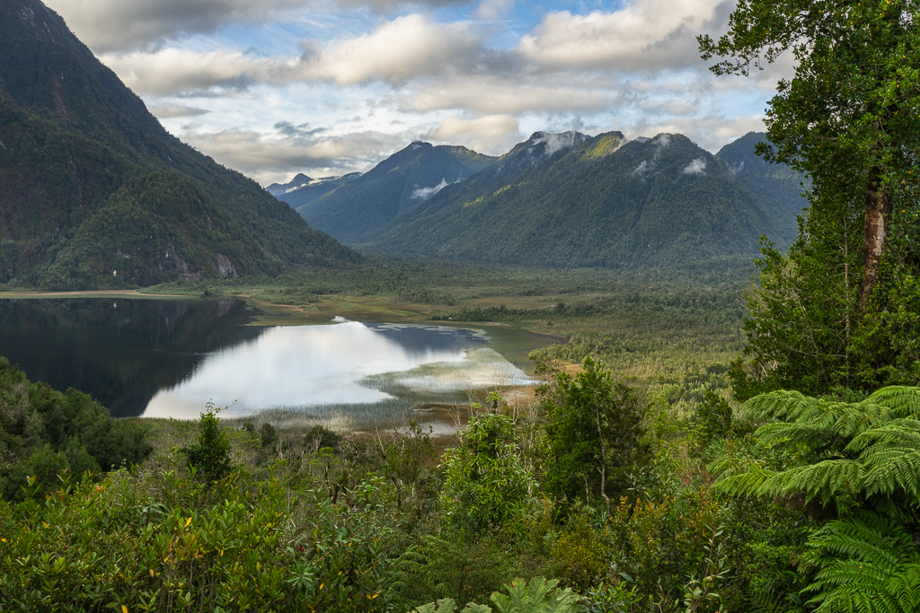
15 km later, we reached the viewpoint of the Lago Rio Negro.

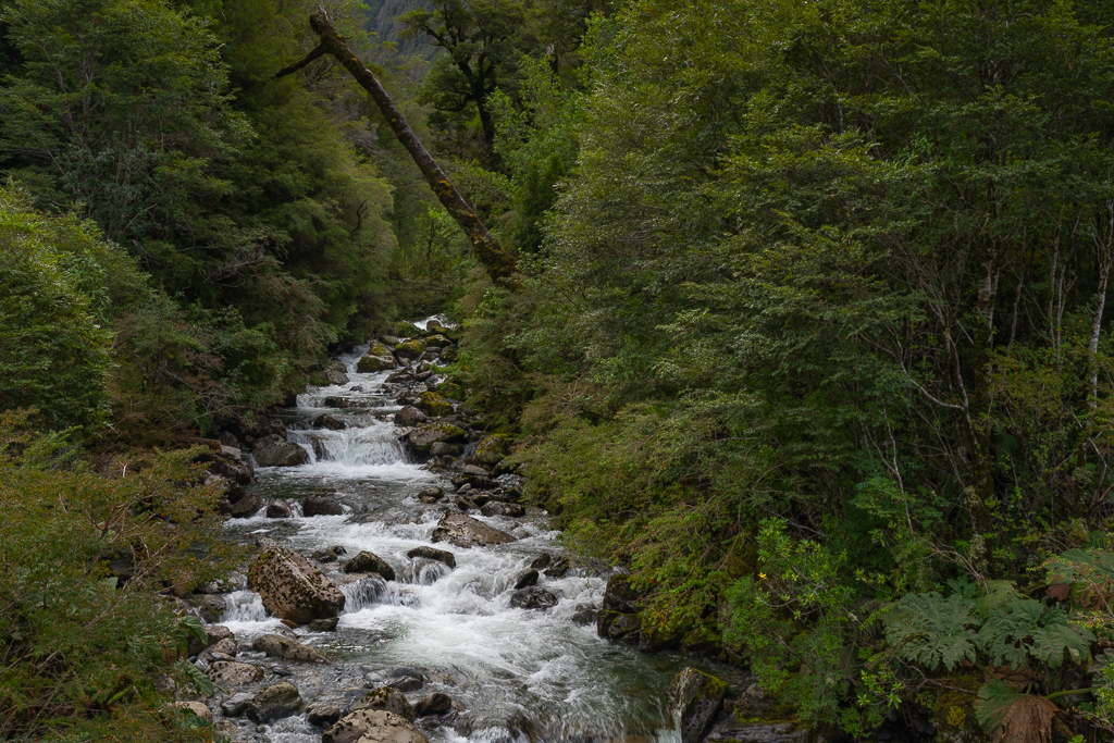
Sendero Cascadas Escondidas
One of the best hikes in the Pumalin National Park is the Sendero Cascadas Escondidas. The trail starts 14 km south of Caleta Gonzalo, is about 4.5 km long (round trip), and takes 3-4 hours. We needed more time due to countless photography stops along the way.
The vegetation on this trail is just mesmerizing. It’s one of the most beautiful hikes I’ve done in my life.
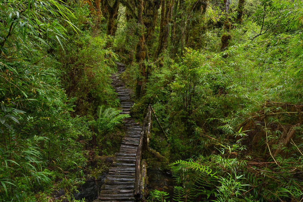


Some parts can be steep and slippery, especially the side trip to the first hidden waterfall, the Cascada Baja.

If your physical condition allows it and you are not afraid of heights definitely do this side trip. This first waterfall is absolutely stunning, albeit not easy to photograph due to the huge amounts of water spray in the air.


On the way to the top, we walked past a few more cascades.


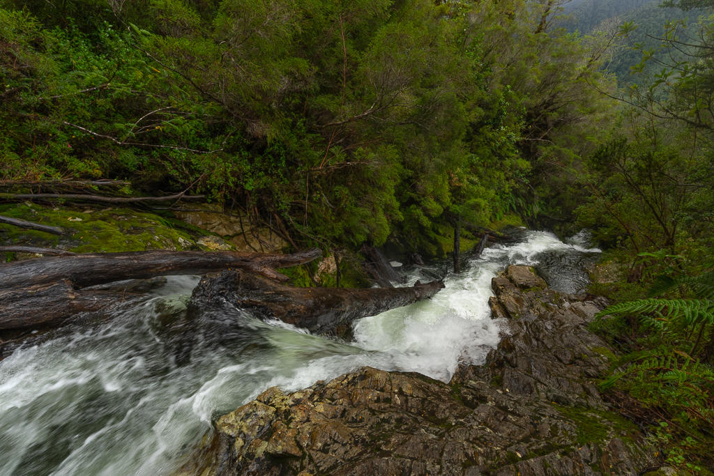
Finally, after another very steep last section, the end of the trail at the stunning Cascada Alta was reached.
Although the Cascada Escondidas trail is only 4.5 km long it’s an exhausting hike. But the effort is so worth it. If you only have time for one trail in the Pumalin National Park I would recommend this one.
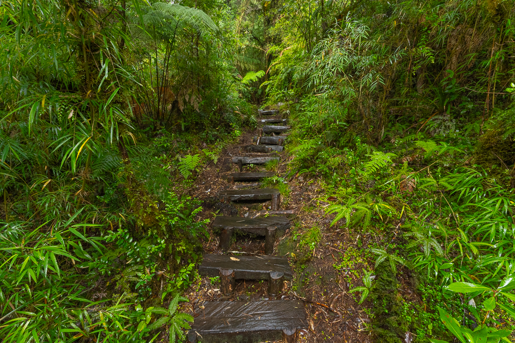
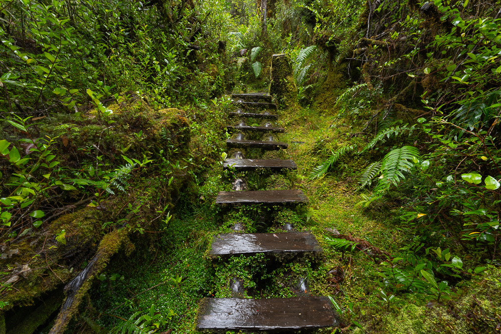
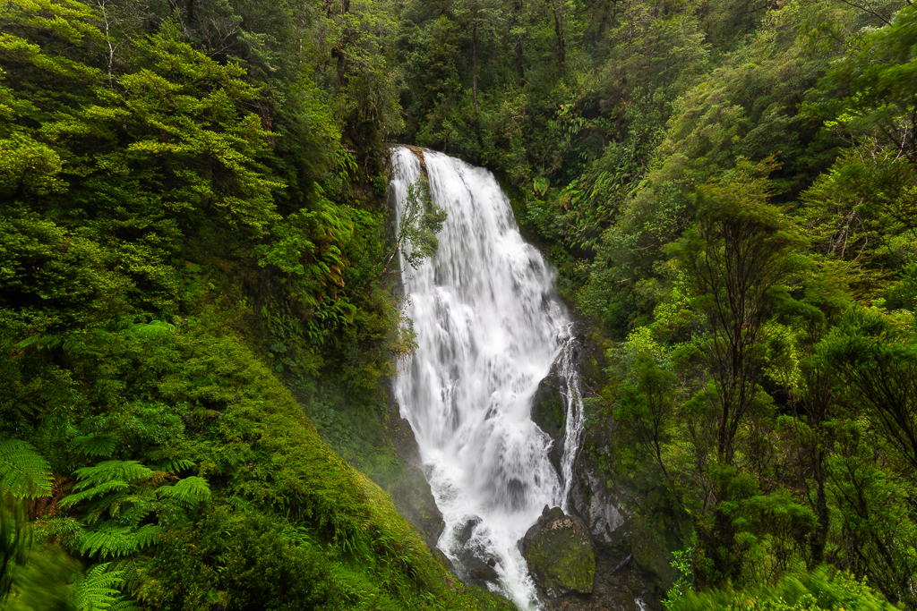
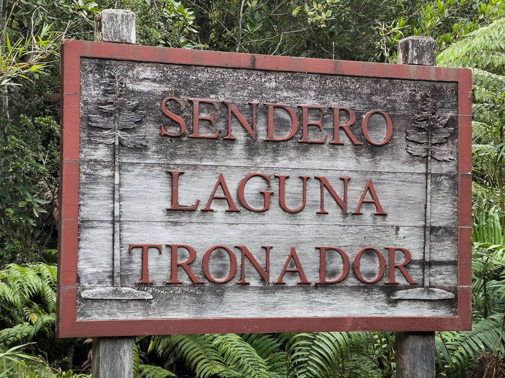
Sendero Laguna Tronador
Next, I explored the Laguna Tronador trail alone, while Kerstin and Linnéa had a rest day at our cabin (recovering from the Sendero Cascadas Escondidas). This trail starts 11 km south of Caleta Gonzalo.
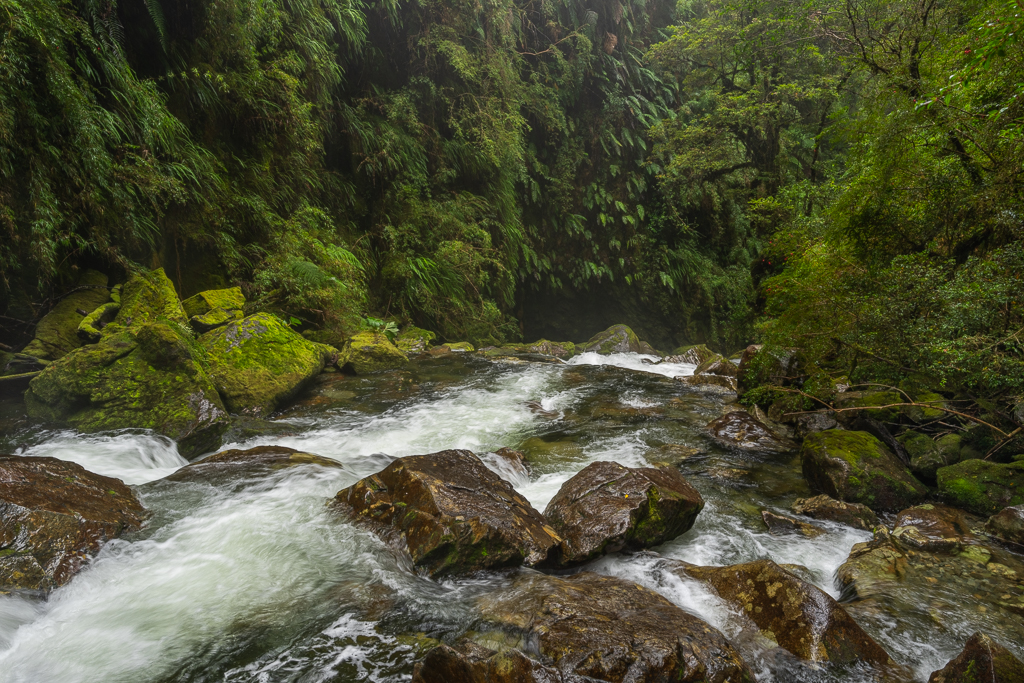
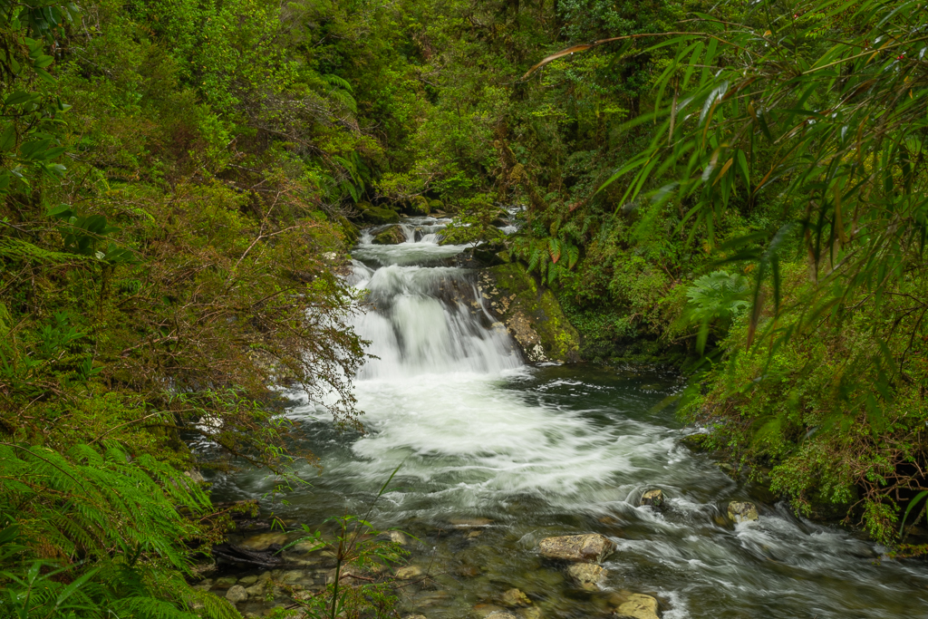
It is 3.6 km long and takes normally about 3 hours (I needed more than 4 hours due to my many photography stops). It’s even a bit steeper than the Cascadas Escondidas trail and most of the trail consists of stairs. If it’s dry it’s an easy walk but with rain, the wooden stairs can get very slippery.


Just a few hundred meters after the start, I reached a beautiful waterfall.
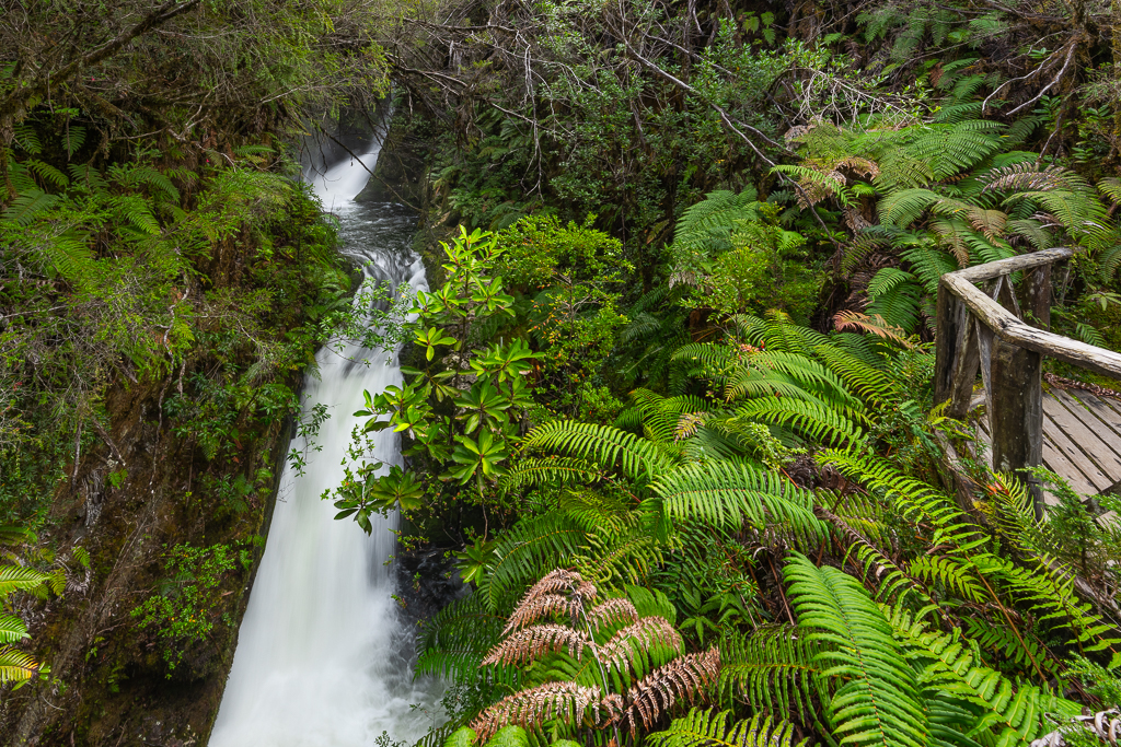
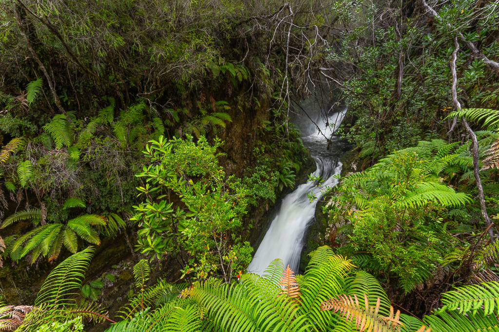

The vegetation along the trail is again spectacular.


At the end of the trail, you can find the Laguna Tronador, a lake surrounded by steep mountains and beautiful forests.
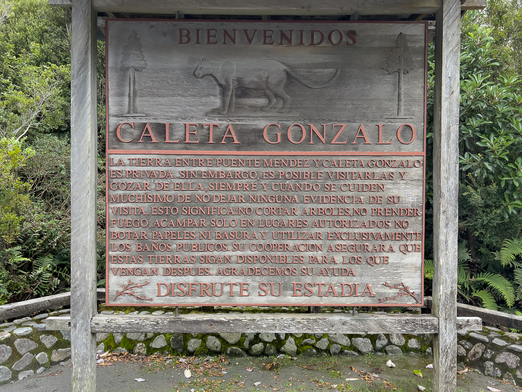
Caleta Gonzalo
If you continue the road through the Pumalin National Park to the north you finally reach Caleta Gonzalo.
The road ends there and you have to take a ferry to continue further north. More about this in the next post.

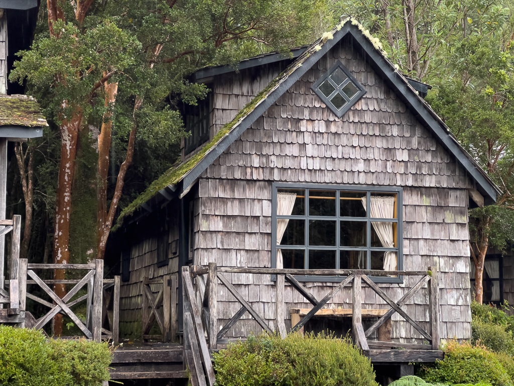
In Caleta Gonzalo, you can rent some lovely cabins, albeit for a very steep price.
And there is a nice little restaurant, the Café Caleta Gonzola. In the morning it’s primarily reserved for the guests of the cabins but in the afternoon it’s open for everyone.

Caleta Gonzalo is also a great spot for watching wildlife. In 2012 I saw many dolphins in the fjord. This time we were mainly watching the different birds.


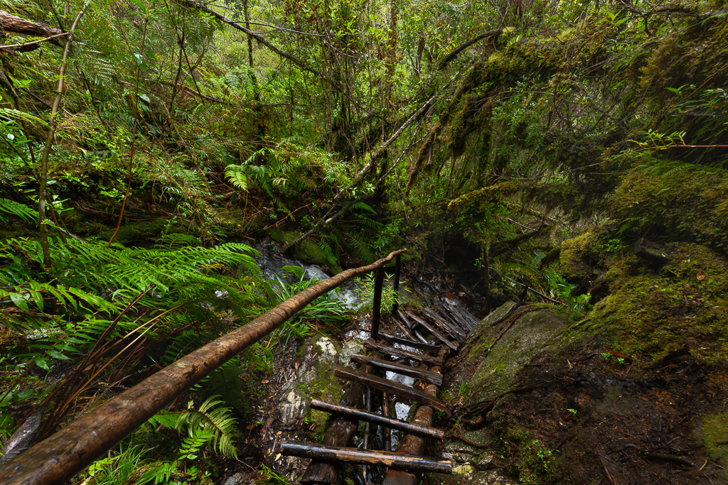
Sendero Cascadas
Directly at Caleta Gonzalo starts the Sendero Cascadas. In theory, it’s a 6 km trail that should take no more than 3 hours. But the trail was closed for a long time and only the first half of the trail was recently rebuilt. The second part of the trail was still extremely overgrown and just a few hundred meters of scrambling over the roots and rocks took me more than one hour. Reaching the end of the trail would have taken the whole day. At some point, I decided to give up. Altogether I was nearly 4 hours on the trail and according to Maps.de not even close to reaching the end of the trail. But since the rangers were working on the trail during my visit the conditions could be completely different now.

As written above, the first part of the trail was in perfect condition and very easy to walk.


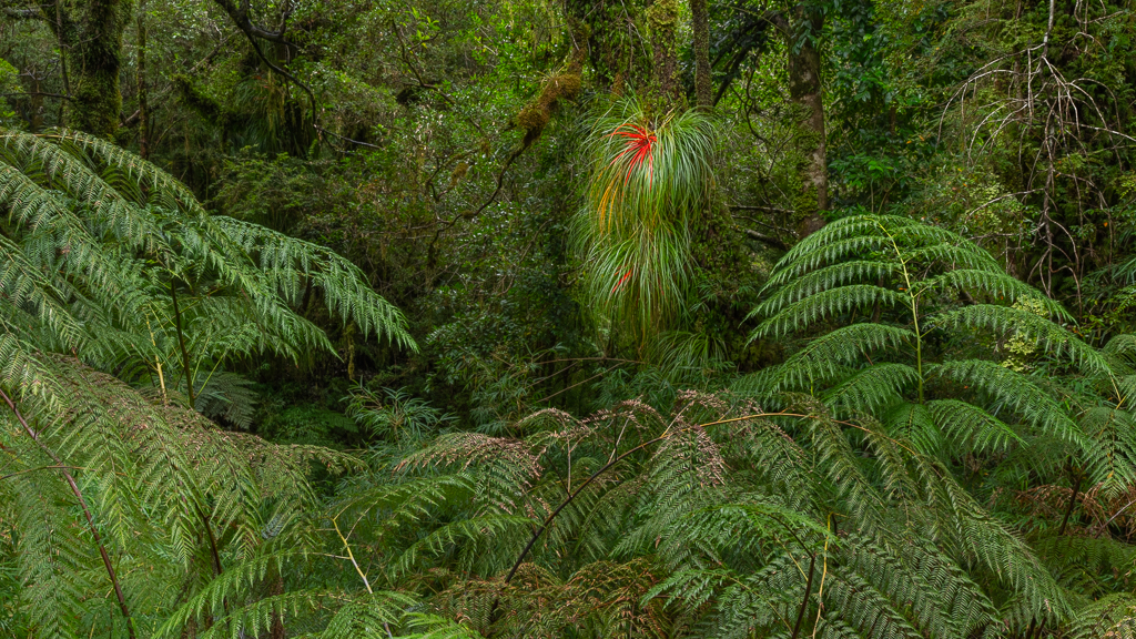


I know that I repeat myself, but the vegetation in the Pumalin National Park is just fabulous.


The Pumalin National Park is still one of my favorite places in Chile and South America. I love the stunning temperate rainforest and could easily spend weeks in this place.

Fantastische Bilder der üppigen Pflanzenwelt, darunter meine Lieblingsblume Chilco (fuchsia magellanica)! Und zum Vulkan Chaitén seid ihr nicht aufgestiegen? – Nur eine kleine Korrektur, Chaitén wurde nicht woanders wieder aufgebaut, das war nur ein Projekt, was nach dem Vulkanausbruch und der Evakuierung der Stadt am Schreibtisch in Santiago geplant, aber von den Bewohnern nicht angenommen wurde. Die meisten sind in den ursprünglichen Ort zurückgekehrt und haben ihn neu aufgebaut.
Hi Malte, danke für Dein Feedback. Den Nebensatz bzgl. neuer Location habe ich gestrichen. Und nein, den Aufstieg zum Vulcan haben wir nicht gemacht. Vielleicht beim nächsten Mal.
Thanks for sharing these great images and the story, continue to enjoy and be safe.
Thanks Dallas!